The meteorological instrumentation installed at the “Italia Costa Rica” station allows real-time and long-term monitoring of the atmospheric phenomena in progress and, in perspective, connected to the national meteoclimatic network, will be able to provide support to the local farmers themselves and the population in relation to the activities forecasting and prevention of extreme weather events. Furthermore, the station constitutes an important support to teaching, internships and training activities promoted by national and international schools and universities, to the local population and to groups of visiting eco-touristic and scientific people, important income for the economic benefits that derive from it, for the Reserve itself and its management.
The area at the “Italia Costa Rica” bioclimatic station is, from the point of view of the regulations of the World Meteorological Organization, a compromise in order to start the measures, evaluate the potential of the site and then possibly think of an installation more suited to the stringent WMO regulations n.8 – Guide to Meteorological Instruments and Methods of Observation. In fact, the purpose of the meteorological station is not synoptic meteorology, but didactic, informative and for research, both in meteoclimatology and as a support to biodiversity studies.
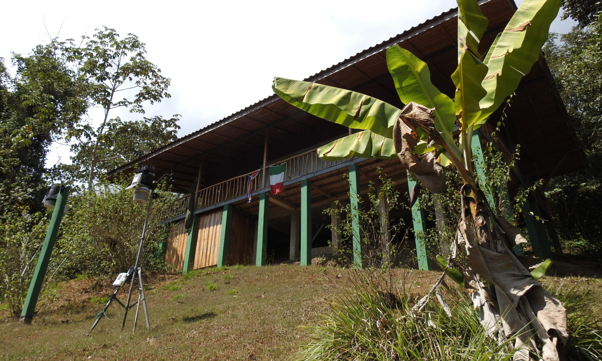
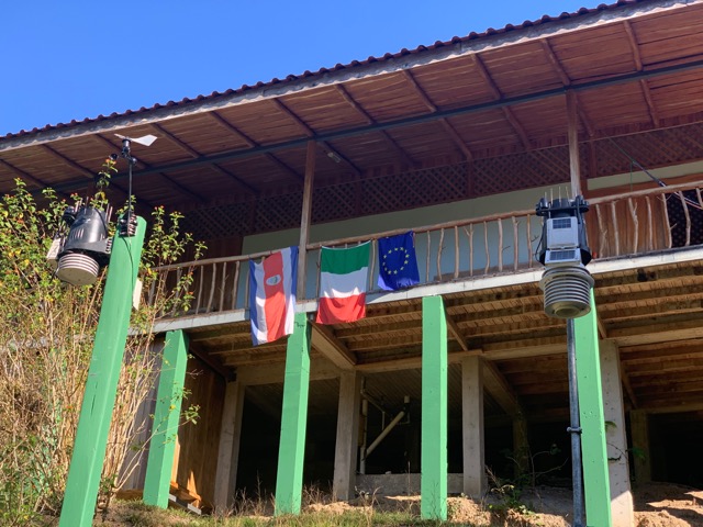
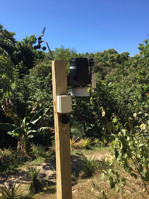
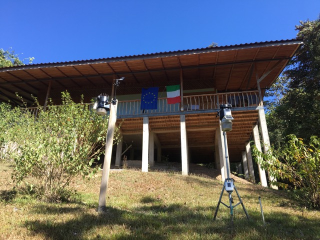
The measuring point is in fact good for temperature and relative humidity measurements, since it is on grassy ground and in a small clearing, at the foot of a small slope, representative of the average conditions of the territory, as evidenced by some measurements carried out with instruments portable. The conditions for measuring precipitation are also good, since the rain gauge has no shadows or nearby obstacles. The measurement conditions for solar radiation are fair, bearing in mind that in the area, with a complex orography, it is difficult to find a point with full sunshine from dawn to dusk. On the other hand, the location with regard to wind measurements is insufficient, which although it is detected is not representative as the anemometer is located only 2 meters above the ground instead of the 10 standards of the WMO regulations, with obstacles such as trees and the station itself. In this regard, the possibility of placing an anemometer with a pole of at least 6 meters on the roof of the station building is being evaluated.
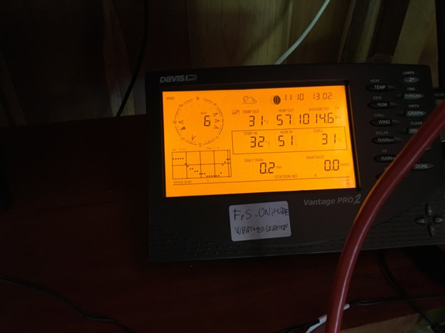
The instrumentation chosen is a Davis Vantage pro plus II weather station, complete with sensors for pressure, temperature, relative humidity, wind speed and direction, precipitation as well as important solar and ultraviolet data.
The station is connected to the internet, available at the station thanks to a radio link, and through the software and data logger “Weatherlink” sends the data to the Geophysical Observatory of the Enzo Ferrari Engineering Department of the University of Modena and Reggio Emilia (DIEF UNIMORE). Data acquisition takes place every 5 minutes, so as to obtain fairly detailed information on the trends of the various weather parameters, especially also for analyzing cases of intense precipitation in a short time or any sudden changes in weather parameters. The weather data can be consulted in real time on this same site of the station, on the site of Foreste per Sempre (www.forestepersempre.org), as well as on a page of the Geophysical Observatory (http://meteo.unimore.it/meteo/karen.php) while the the archive and the monthly and annual calculations are managed in the weather network of the Geophysical Observatory of DIEF UNIMORE in Modena.
The weather station, purchased by the Association Foreste per Sempre and managed by the Geophysical Observatory of DIEF UNIMORE, has been operational since February 20, 2017. Previously, the first data was collected through an obsolete weather station which has now been replaced by the new station.
Webcam
In addition to the weather instruments, a Mobotix webcam mod. M24, with a shot of part of a hill, where there is also the teaching room and part of the sky, so as to have information both on the state of the trees and the forest, and on the presence and type of clouds. The webcam has not only visual and informational purposes, including tourist ones, but it is a valid atmospheric monitoring tool and, when there is a sufficient data set, it can also be useful for evaluating computer and automatic analysis models (computer vision) also with artificial intelligence technologies.
Some examples of webcam timelapse processing
• lightning of 19 11 2016 to Karen Mogensen Costa Rica
https://www.youtube.com/watch?v=teQQwRH1JFg
• Hurricane Otto Tail Pass in Karen Reserve, Costa Rica
https://www.youtube.com/watch?v=VocyNycyPrc
• timelapse December 2016
https://www.youtube.com/watch?v=QxKcqNnrkNk
• timelapse January 2017
https://www.youtube.com/watch?v=cmCBiqrABJY
• timelapse April 2017