
El Niño 2026: Forecasting alone is not enough. We need to prepare
An exceptional event in the Pacific could have significant consequences for Costa Rica
In Costa Rica, the onset of El Niño can mean higher temperatures, less rainfall and longer dry spells, especially on the Pacific side of the country. Even amid drought and wildfires, sudden downpours, thunderstorms and rapidly rising rivers can cause widespread flooding.
What is El Niño?
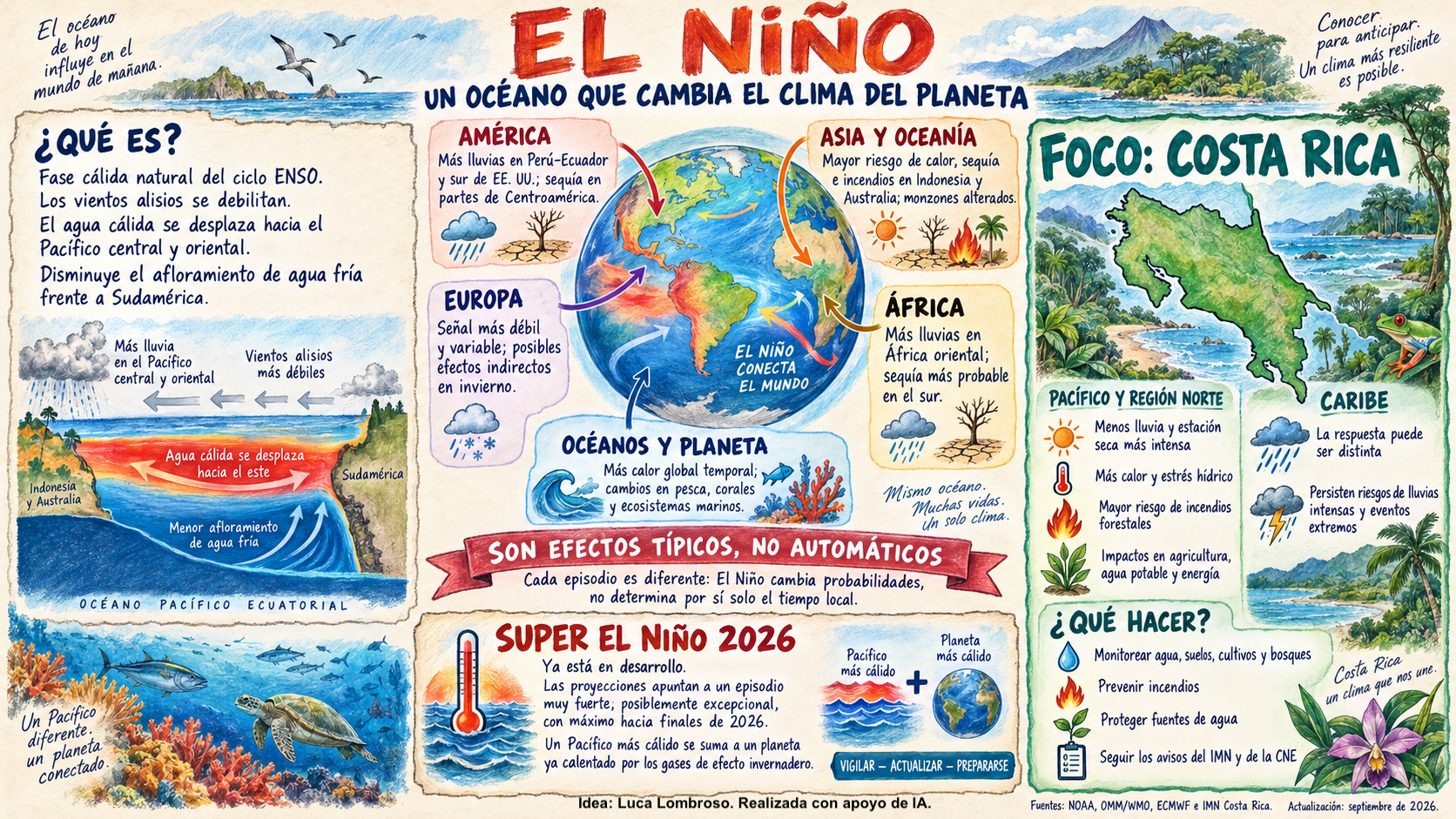
El Niño is the warm phase of a natural climate pattern known as ENSO, the El Niño–Southern Oscillation. It occurs when surface waters in the central and eastern equatorial Pacific become warmer than usual. One mechanism that helps El Niño develop is a weakening of the trade winds. Warm water shifts eastward and less cold water rises to the surface, amplifying the warming of the equatorial Pacific.
Ocean warming alters winds, tropical rainfall patterns and atmospheric circulation. Through what are known as teleconnections, its effects can extend far beyond the Pacific, influencing temperatures, rainfall, drought, tropical cyclones and extreme weather in many parts of the world.
Every El Niño is different. Its effects now unfold against a backdrop of ongoing global warming, which can amplify its impacts. Atmospheric circulation and local conditions help determine how those impacts play out. As the European Centre for Medium-Range Weather Forecasts (ECMWF) points out, global warming changes the conditions in which El Niño operates. Today, natural variability plays out on a much warmer planet.
Super El Niño is already here
In NOAA’s 2 November 2026 update, the latest weekly sea surface temperature anomaly in the Niño 3.4 region was +2.5°C.
Seasonal forecasts indicate further strengthening toward the end of the year. The WMO update of 21 October projects:
- An average Niño 3.4 anomaly of around +3.8°C for November 2026 to January 2027.
- A possible peak around December.
These are projections from a multi-model ensemble. The corresponding temperatures have yet to be observed.
According to NOAA’s October assessment, a strong or very strong El Niño remains likely through January–March 2027. NOAA assesses these categories using the Relative Oceanic Niño Index (RONI), which accounts for average warming across the tropical oceans and differs from the conventional Niño 3.4 anomaly.
We can therefore speak of a “Super El Niño” scenario, using the informal term for particularly intense events. Calling it “the strongest on record” would be premature. The projected peak has yet to be observed, and comparisons with past events require consistent indices, data and climate baselines.
What could this mean for Costa Rica?
In Costa Rica, especially on the Pacific side, El Niño episodes are often associated with:
- Below-average rainfall.
- Higher temperatures.
- Longer or more frequent dry spells.
- Greater stress on forests, agriculture and water resources.
- Conditions that make fires more likely to start and spread.
The effects vary across the country. The Caribbean side may respond differently, and much depends on how regional atmospheric circulation evolves.
Even in an overall drier season, intense rainfall remains possible. Severe thunderstorms, downpours concentrated within a few hours, flooding, landslides and flash floods can all occur. Seasonal outlooks should therefore be used alongside short-term weather forecasts and official alerts from the Instituto Meteorológico Nacional (IMN) and the Comisión Nacional de Emergencias (CNE).
Three risks to prepare for
Wildfires
Heat, wind and drier vegetation make it more likely that a small ignition will quickly turn into a fire that is difficult to control.
Prevention starts with taking great care around even small fires along roadsides or during agricultural work. A simple barbecue on a beach or in a green space can also pose a risk. Clear accumulations of combustible vegetation from areas most exposed to sun and wind. Strengthen monitoring and reporting through regular patrols, and report fires through the designated emergency channels. In Costa Rica, call 911 or use the Emergencias 9-1-1 CR app. Local institutions and associations can also strengthen response capacity by training volunteer fire crews (brigadistas).
Water shortages
Reduced rainfall can mean less water for communities, crops, livestock and the ecosystems that support biodiversity. Protecting springs and groundwater recharge areas, using water carefully, reducing waste and arranging alternative sources of supply can help communities act before shortages become an emergency.
Extreme weather
Seasonal drought and intense rainfall can occur in the same season. Very dry, degraded or fire-affected soils can absorb sudden downpours less effectively, increasing surface runoff.
Keep drainage systems and waterways clear, monitor unstable slopes, and prepare warning systems and evacuation plans.
What can individuals do?
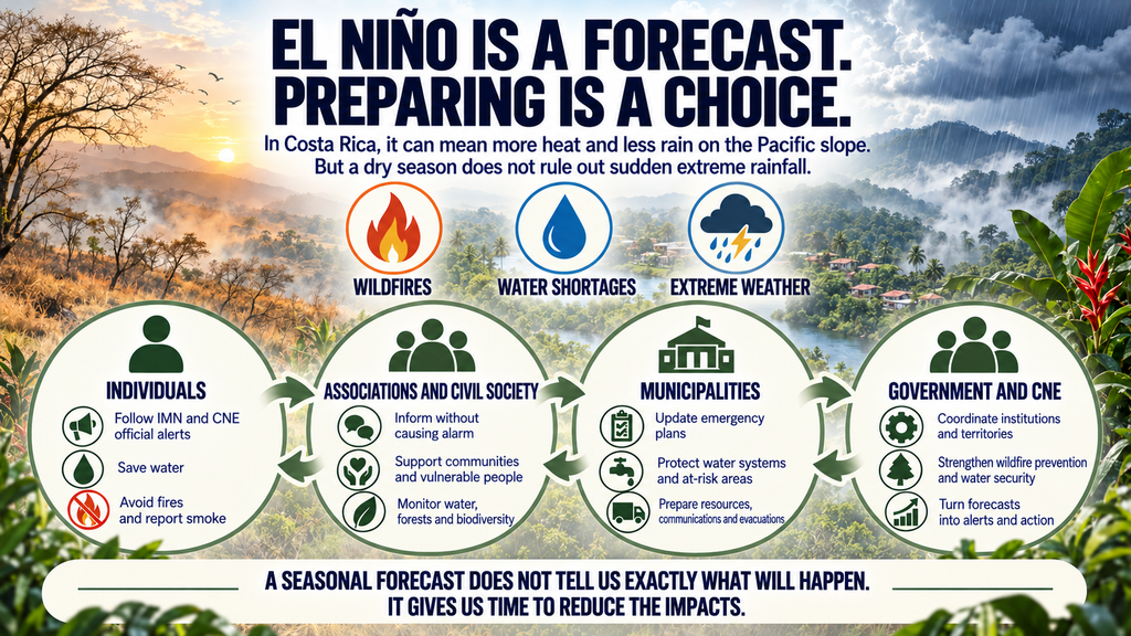
- Follow official IMN and CNE alerts and use them as the primary source of information.
- Reduce water waste and prepare for possible interruptions to the water supply.
- Avoid lighting fires or burning vegetation waste during high-risk periods.
- Report smoke, fires, landslides and blocked waterways immediately.
- Make a simple household plan covering water, medication, pets and communication.
Prevent fires from starting, conserve water and know the risks in your area.
What can associations and civil society do?
- Share clear, verified and measured information.
- Work with municipalities, schools, farmers and isolated communities.
- Support people who are most vulnerable during heat, drought and emergencies.
- Encourage community monitoring of springs, vegetation, fires and biodiversity.
- Organize volunteer firefighting with appropriate training and coordination with the relevant authorities.
- Restore forest ecosystems and protect groundwater recharge areas.
What can municipalities do?
- Update and activate their Municipal Emergency Committees.
- Map the communities, water supply systems, crops and infrastructure most at risk.
- Check water reserves, wells, tanker trucks and alternative distribution systems.
- Reduce combustible vegetation and regulate open burning in high-risk areas.
- Clear drainage systems and waterways ahead of possible intense rainfall.
- Prepare emergency communications, evacuation routes and shelters.
What can the government and the CNE do?
- Combine IMN forecasts with scenarios showing potential impacts in different areas.
- Coordinate the CNE, SINAC, the fire service, AyA, MAG, health services and local authorities.
- Strengthen surveillance and firefighting resources in the most exposed areas.
- Protect water supplies, energy systems, agriculture and critical infrastructure.
- Position equipment, personnel and supplies in vulnerable areas ahead of time.
- Issue alerts in stages, explain them clearly and tailor them to each area.
- Update impact scenarios regularly to reflect the different effects El Niño can have across the country.
The CNE’s role is to coordinate the National Risk Management System. Prevention works when meteorological services, public institutions, municipalities, associations and communities act together before an emergency.
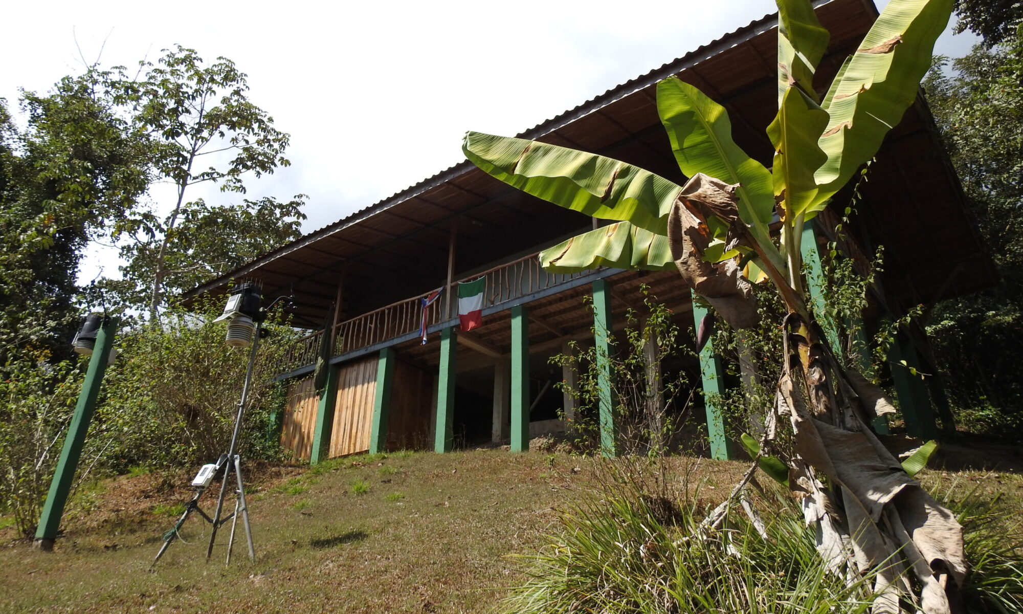
The role of the Italy–Costa Rica biometeorological and climate station
The station at the Karen Mogensen Reserve will continue to monitor temperatures, rainfall and other atmospheric variables and report its findings through regular bulletins and newsletters.
The observational record, which began in 2017, is still relatively short, but it can already document anomalies, dry spells and intense weather events. If the projected Super El Niño develops as the models indicate, the data collected in 2026 and 2027 will be especially valuable for studying its effects on the tropical forest on Costa Rica’s Pacific side.
Local monitoring complements national meteorological networks. It helps show how a large-scale global phenomenon translates into changes in temperature, rainfall, water availability and forest conditions at a particular site.
Observing to protect
“Observing to Protect” was the theme of World Meteorological Day 2026. Observations help us better understand extreme events, anticipate their impacts and make more informed decisions.
It was also the theme of the seminar at the University of Costa Rica (UCR), organized by the Embassy of Italy in Costa Rica.
El Niño is a natural phenomenon, and in 2026 it is unfolding on a planet already warmed by human activities. Tracking its development gives us time to protect people, water, forests and biodiversity. A seasonal forecast can tell us what is more likely. Observing today helps us protect tomorrow.